Willow River
Once a premier fly fishing stream in Wisconsin.The River
The Willow River is a tributary of the St. Croix River that wanders for 40 miles through the low-lying hills of St. Croix county in Western Wisconsin. Its origin is in and around the Cylon Wildlife Area, near the village of Deer Park (near the northern border of the county). It then passes through the towns New Richmond, Boardman, and Burkhardt. Near Burkhardt it enters the Willow River State Park, then on to join the St. Croix River near Hudson, Wisconsin. Approximately 25 miles of the Willow have been listed as respectable trout habitat.
Resource Challenges
Only 25 miles east of the Twin Cities metro area of over 3 million people, the Willow was once considered the prime fly fishing river in the state. Due to urban sprawl and water temperature increases, the Willow has declined as quality trout water since the 1980s. The Willow has experienced general warming overall, which can be attributed to urbanization and loss of groundwater flow from residential wells and large commercial farming operations. This once prime water may never again regain its former quality and stature.
” Only 25 miles east of the Twin Cites metro area of over 3 million people, the Willow was once considered the prime fly fishing river in the state.”
River History
The river at one time dumped into the lower St. Croix River in between Hudson and North Hudson. But a dam was built to block off its mouth, a narrow channel was cut above the dam to the St. Croix River, the channel was dammed, and a mill was built to exploit the head of water that the two dams created. Subsequently, the Willow River Power Co. built a hydroelectric facility to utilize the same head of water, but the head was substantially decreased when the United States built the Red Wing Dam 30 miles downstream on the Mississippi River.
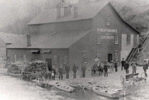
By 1830 logging and wheat farming were common in the Willow River Valley. The river was invaluable, as logs were floated downstream to the St. Croix. A German immigrant, Christian Burkhardt, realized the river could also be harnessed for the latter industry, and built a grist mill here in 1868. Burkhardt became a wealthy landowner and followed developments in water-powered industry. He traveled home to Germany to examine hydroelectric power plants and returned in 1891 to build his own on the Willow River. Burkhardt eventually built four power plants and dams on the river, which provided electricity to Hudson. Northern States Power purchased Burkhardt’s power company in 1945 and operated its sites until 1963, when damage to one of the plants from a lightning strike prompted the company to liquidate their Willow River holdings.
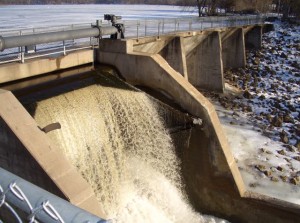
In 1967 Northern States Power sold the land to the Wisconsin Conservation Commission for a state park, and stabilized the dams at a financial loss. The state park opened in 1971. Some of the dams were removed in the 1990s to improve the scenery and trout fishery, and now only one remains. The land is still being restored from damming and farming.
The Willow is known by 3 sections, many different faces.
The Upper Section from the headwaters at Cylon marsh, through the town of New Richmond, the river lazily winds back and forth with a slow flowage. Trout can grow large in this section, but numbers do not compare to other nearby streams. The slow flow dictates streamer patterns for fly fisherman, or spinners and crankbaits for the hardware folks. Downstream of New Richmond, it slows substationally and takes on the character of a warmwater fishery.
Not until it begins its southwesterly flow to a few miles upstream of Willow River State Park does it pick up speed and a few springs that lower the water temperature that it can support stocked browns and rainbows. In the past few decades three dams were removed to limit siltation and increase flow, with hopes of improving the fishery in this section.
Anglers may want to consider giving the upper Willow River a try near County Highway T east of New Richmond a try. This area is known for trophy 20-plus inch trophy brown trout. DNR field surveys conducted found consistent production of 16- to 20-inch brown trout and an occasional fish larger than 20 inches. The South Fork, a tributary stream to the upper Willow River, is often over looked but has a mixed brook and brown trout fishery of good quality and size structure.
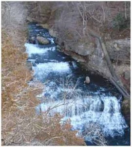
The Park Section starts near Burkhardt, the river picks up speed and flows to the canyon of Little Falls. This area is quite beautiful and the falls is quite a sight to see. The Willow takes on a freestone character, until it empties into Little Falls Lake, a man-made reservoir created from the lone remaining dam inside this section of the Park.
Below Little Falls Dam the Willow meanders through gently rolling hills. You never know what will come to your line in this section; from decent sized brown trout to northern pike or smallmouth bass that has migrated from Lake Mallileu. Presence of warmwater species in this section can be attributed to warm water spilling over the top-release dam. until it splits into the Willow River and Willow river Race sections. More than 5 miles of the best fly fishing water are within the park.
The Willow and Willow Race Section starts a mile or so downstream from Little Falls Dam; the river runs faster with larger boulders and undercut banks. The mile long Race section, which is considered the better of the two parallel sections, has had extensive bank improvements and lunker structures added in past decades, and provides good shelter for stocked brown trout in the river. This section has more spring seepage than the Willow section, and has had extensive research and improvements in the past 35 years. Even though this section has had great expectations in former years, little or no reproduction occurs in this section.


